Everything posted by Slacks
-
Christmas 2025
Merry Christmas, Ho Ho Hoes.
-
Prime Rib Christmas (Let's talk)
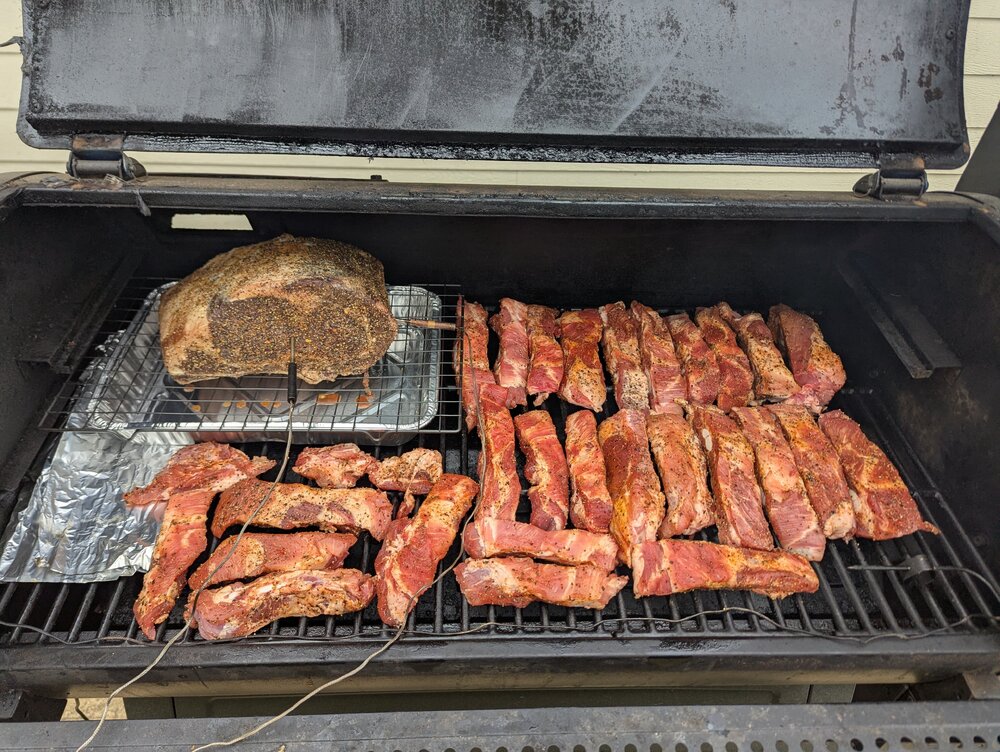
A three rib and some party ribs went on smoke this morning. Trying to decide if I sear this one or not. Probably not.
-
Trumps War on Everything
- 2025 Self Gratifying Fantasy Football thread
Made it to the final and offered a split. My QBs: Lamar - injured McCarthy - Injured Love - Injured Dart - NY Giant I don't see a path to bragging rights on this one.- Jeffrey Epstein needs his own thread
Whaaaaaat? All this time I thought.. no, I knew... there had to be a reason. I thought it was because he wouldn't buy the fries.- ChatGPT AI Tool— We all work for robots now
This is absolutely coming. I know someone developing a thing. If you thought your wife / partner / whatever was buying all the shit on Amazon already, just wait... Everything will be a lead up to some consumer shit just for you. (Like it already is)- Chefs leaving KCMO for KCKS
Can confirm. Funny old lady working the Coffee Bar in Des Moines airport had a Chiefs logo neck tatt. She was a hoot.- 2025 Self Gratifying Fantasy Football thread
I have FOUR QBs rostered. They scored 16 points combined this week. My starter, the only QB that played a full game, put up 0.02. I am still up 30, because Puka is a maniac. I am going into the championship week with 4 QBs, which means I have none.- BOOM MOTHER FUCKER - Will Muschamp's Triumphant Return
Gotta say, my nostalgic old ass was happy to have Akina come back. But now, I think nostalgia is dumb and we should just fire Muschamp before he fails.- I pledge to post more pictures of this STEAK
I like cutting thicc ones... A la Vic Mackey- The Lost Generation essay
Is this about being called "Suspicious"?- 2025 CFP First Round - The "U" @ aggy
- This is who Steve Sarkisian is.
I am going out on a limb here... But I'm guessing nobody on Surly has ever looked like Lo. Yet and still, the question remains.- BOOM MOTHER FUCKER - Will Muschamp's Triumphant Return
As someone admitted in the 80s and again in the 90s, I can confirm this to be absolutely correct.- BOOM MOTHER FUCKER - Will Muschamp's Triumphant Return
I hope some of y'all muthafuckas do get in the muthafucka. I miss that muthafucka.- BOOM MOTHER FUCKER - Will Muschamp's Triumphant Return
IU dominated tOSU at the end of the year when it mattered most. I am not convinced tOSU had the great offense people think they had. tOSU played 3 teams with a defensive pulse. 14, 27, 10.- BOOM MOTHER FUCKER - Will Muschamp's Triumphant Return
same thing Patterson recommended... same thing Greg Robinson did... let dudes hit the ball. don't get cute on defense. As a buddy of mine says, "D-Line, just go forward. Safeties, don't get beat deep. LBs and CBs just make plays. You've all been doing this since you were little."- BOOM MOTHER FUCKER - Will Muschamp's Triumphant Return
But i do hope to see some additional pressure instead of dropping 8 against a mobile QB- BOOM MOTHER FUCKER - Will Muschamp's Triumphant Return
Thanks. From the cut, it looked like he was coming from a LB spot- 2025 Texas Coaching/Support Staff Thread
- BOOM MOTHER FUCKER - Will Muschamp's Triumphant Return
Looked like a Zone Blitz / Fire Blitz... Which I don't recall seeing a lot of under PK. So, actually, you do hope to see more of it, and I think you will. I think PKs philosophy is more about covering than pressuring. "Don't get beat" But that means a mobile QB (which is all of them) can move around enough to create time, which creates space. It's why 3rd and PK exists. It's why we say the front and the back didn't match. The back played off and the front didn't bring extra bodies, but simulated pressure with 2 DL. Show 5 and bring two. Why? QBs can see and adjust to even if the OL doesn't see it right away. Too much time. Muschamp is going to bring pressure and trust the back to cover for a short period. Watch... Our DBs are going to look like they can cover again on 3rd down. Crossers will win from time to time, but will also turn into pics more often.- BOOM MOTHER FUCKER - Will Muschamp's Triumphant Return
In summary....- BOOM MOTHER FUCKER - Will Muschamp's Triumphant Return
One.- BOOM MOTHER FUCKER - Will Muschamp's Triumphant Return
He might be HCIW again.- 2025-26 Houston Rockets Thread - Back to Contention?
Zion must be terrible. Bro goes out down 22 late in the 3rd. Never comes back and his squad wins in OT. KD has to get off the ball. He's not a Point Forward and is creating too many turnovers. Is pace an issue for the Rockets? Young & fast teams seem to cause an issue. - 2025 Self Gratifying Fantasy Football thread
Football ...
Basketball ...
Baseball ...
Other Sports ...
Futbol ...
🤫995🤫 ...
Gambling ...
Movies & TV ...
Music ...
Hobbies ...
Lulz ...
Food & Travel
...
Daily Texan ...
Business & Markets ...
Cloak Room ...
Help ...
For Sale ...
Board Discussion ...
Advertise...
Tailgate Donations
Back to top
.thumb.webp.808cabacb8589096604a8beb99ea0882.webp)


