Jump to content

Hagbard Celine

Legacy Members
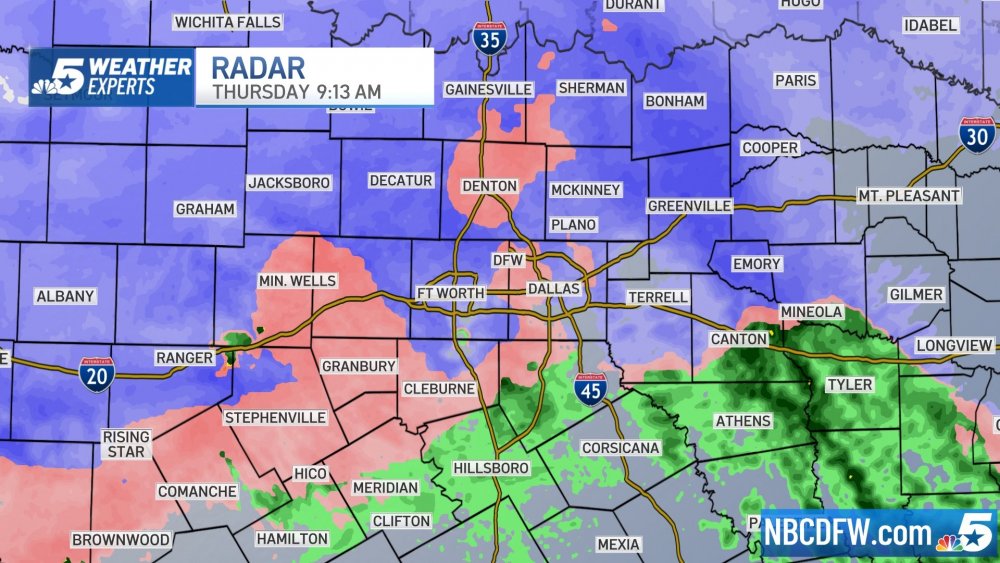
  • Posts

    17792
  • Joined

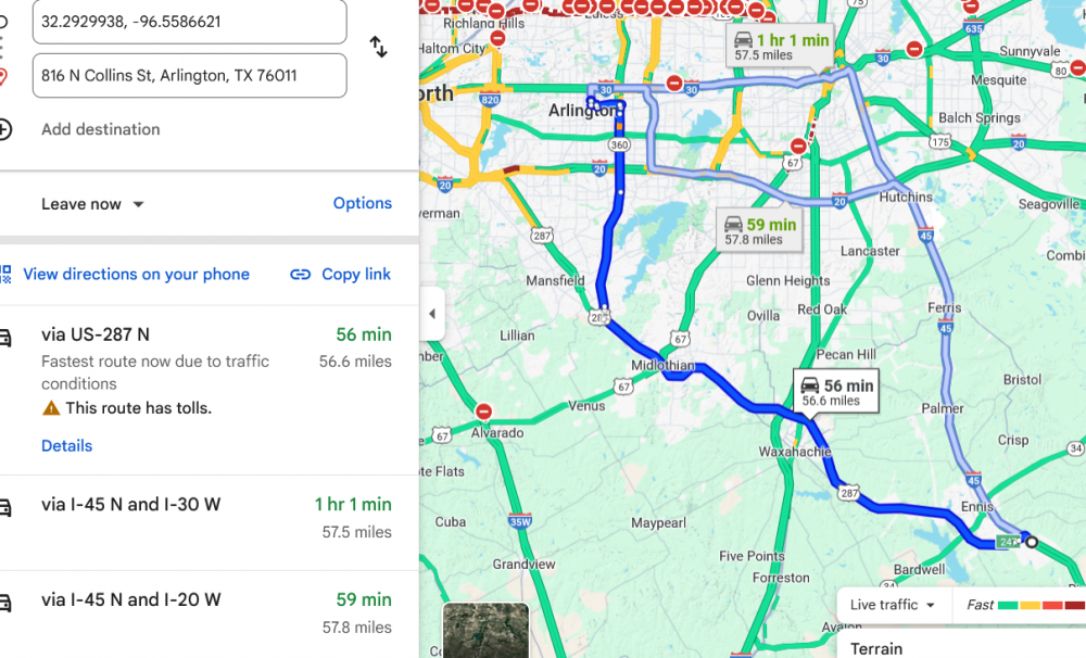
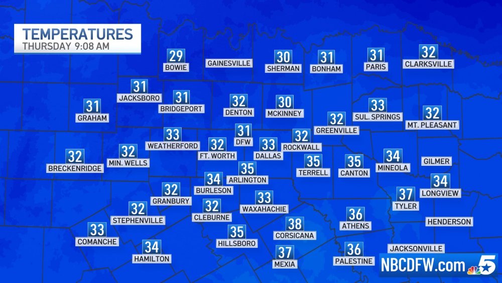
Everything posted by Hagbard Celine

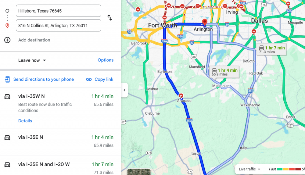
  1. for those with any of the toll badges, 287 to 161 from either austin or houston would be my #1 play the ntta system will be the safest roads in the metroplex
  2. double-edged sword: above freezing downtown fort worth will be sanded out the gazoo, and the north 35 to east 30 ramp is only elevated for 300 feet: all else equal, your route backtracks and is not 1 of the 3 google suggestions.... that said it could be the best play - who knows as the situation changes from hour to hour it's all about what google traffic is showing in realtime having every cell in your vehicle loaded with google turn-by-turn for a different route is the way to go... you will get a "recalculating" message if that route craters
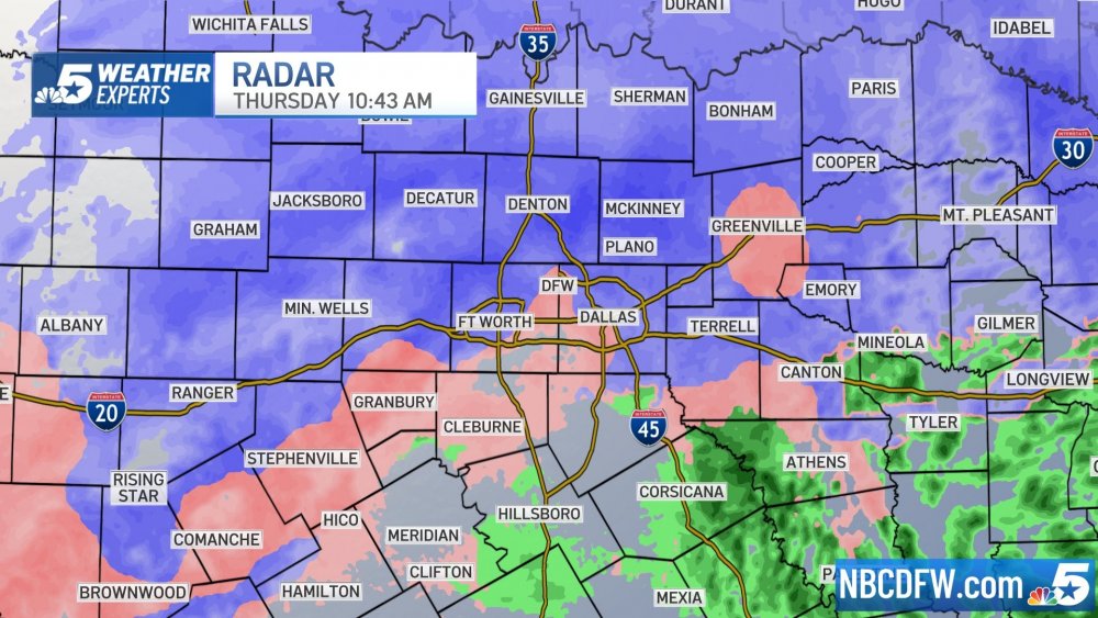
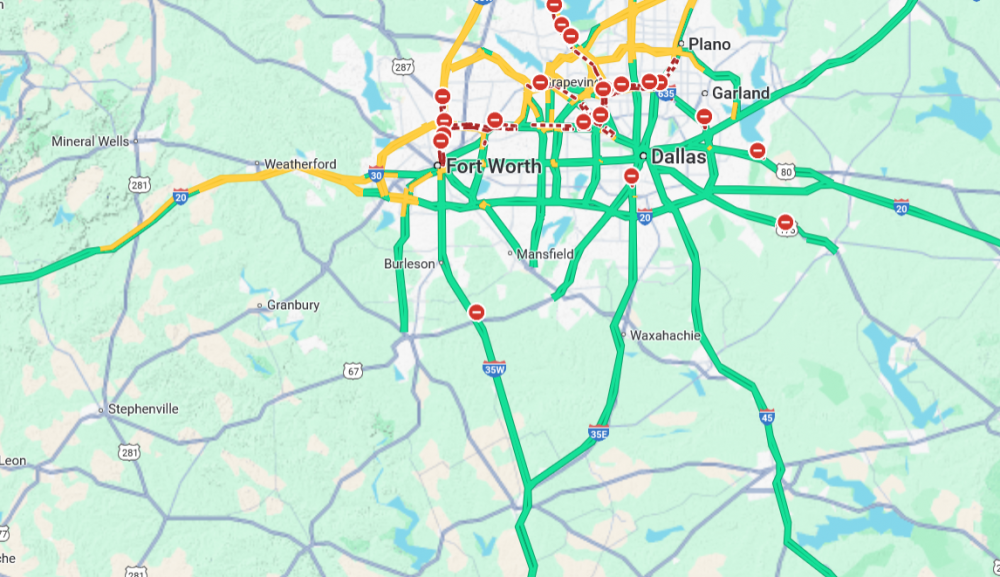
  3. @The Golden Hat i had not looked at the radar in an hour.... by the time you get to hillsboro a winter mix blob is likely to have moved over i35 current temps: hillsboro 35f,, wax 32f, cleburne 33f consider this in your decision - you may be down to 30mph from the split, i.e. 2+ hours to i20
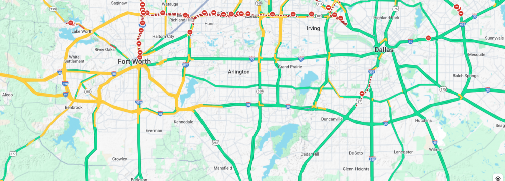
  4. anyone who has that option, it might be a cunning plan right now it looks like 75mph is in play well past the split and i'm guessing very little traffic
  5. excellent summary which i agree with, tl/dr: +++ Overall, climate change may be contributing to the fire danger of this event, but only if the warming/drying influence outweighs the potential reduction in Santa Ana winds. To me, that means climate change does not deserve primary billing (e.g., https://x.com/dwallacewells/status/1877030739344081343) Fire suppression and the long-term build-up of fuels are not as much of an issue in the Southern California brush environment as they are in the Northern CA Forests, but our machine-learning wildfire intensity model indicates that fuel treatment would still reduce danger substantially. Other than that, the main way these types of events can be mitigated in the future is via reduced human ignitions, potentially increased firefighting resources, and enhanced “home hardening” measures within fire-prone communities.
  6. kxas temperature forecast - exact location unknown - assuming this is DFW Airport - it *should* be at least 1 or 2 degrees warmer on all ingress roadways ennis is the diversion point for the 3 ingress routings
  7. here's the options from houston - again 3 almost equal in distance/time as of this moment, tomorrow at 2pm they could vary
  8. target: tailgate the best thing you can do tomorrow is have a competent shotgun google map analyst, either in the vehicle with you, or remote on hands free device someone not driving should be monitoring the freeze line, road status (black/red/yellow/green) and the surl for real-time reports in this thread this cap shows 3 different routes from the i35 split to the tailgate location at 816 North Collins 76011 i have comments about each of these routes but will hold off until later this afternoon as we see how the day plays out
  9. fort worth slowing down ignore all of the red - that's construction closures - all main lanes are "open"
  10. google traffic is the best road condition indicator see the mirror of yellow in the google cap with the current temp map
  11. i watched the precip roll over nortex at 6am winter mix reached as far south as the i35 split, then was followed up with rain based on the traffic flow it didn't glaze
  12. my apologies for taking the comedy angle when this thread started
  13. i am totally lost panama and greenland discussion = political what the fuck
  14. USN will perform a missing-man formation flyover just before final internment on thursday +++ https://www.navymemorial.org/press-room-1/2024/12/31/official-state-funeral-schedule-for-former-president-jimmy-carter THURSDAY, JAN. 9, 2025 7 a.m. Lying in state and public visitation end. 9 a.m. President Carter’s remains are removed from the Capitol with a ceremony. 9:30 a.m. President Carter’s remains arrive at the Washington National Cathedral, where a brief arrival ceremony is held. 10 a.m. The National Funeral Service for President Carter takes place. 11:15 a.m. Upon conclusion of the funeral service, President Carter and his family will travel by motorcade to Joint Base Andrews. 11:45 a.m. The president’s remains and family will board Special Air Mission 39 for the final journey home to Georgia. 2 p.m. Special Air Mission 39 arrives at Lawson Army Airfield on Fort Moore, Georgia, where President Carter’s remains will be transferred to the hearse for a motorcade to Plains, Georgia. 3:30 p.m. The motorcade carrying President Carter’s remains and his family arrive at Maranatha Baptist Church in Plains. 3:45 p.m. A private funeral service takes place at Maranatha Baptist Church. 4:45 p.m. After the funeral service, the late president and his family travel by motorcade to the Carter residence. The public is invited to line the motorcade route through his beloved hometown of Plains. The U.S. Navy will conduct a “Missing Man” formation flyover in honor of former President Carter’s naval service and time as commander in chief shortly after the motorcade’s arrival at the residence. 5:20 p.m. A private interment ceremony takes place, concluding the schedule of events.' +++ also.. https://www.koat.com/article/jimmy-carter-funeral-atlanta-whats-next/63350549
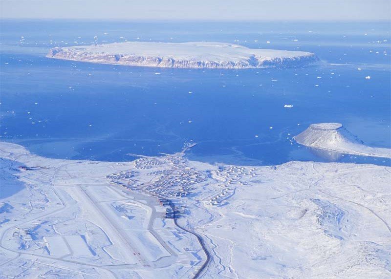
  15. no direct link to the current kxas forecast video but it's on this page: https://www.nbcdfw.com/weather/ i trust this guy he is great in tornado situations for thursday and friday he essentially confirms the kxan take from mid-afternoon although the kxas radar forecast stops thursday night at 6
  16. another 48-hour delay 3-hour window opens 23:59pm central thursday night +++ If all goes according to plan, New Glenn will lift off for the first time on Friday (Jan. 10) from Florida's Cape Canaveral Space Force Station, during a three-hour window that opens at 1 a.m. EST (0600 GMT). "This is our first flight and we’ve prepared rigorously for it," Blue Origin's Jarrett Jones, SVP, New Glenn, said in a Monday evening (Jan. 6) statement that announced the target launch date. "But no amount of ground testing or mission simulations are a replacement for flying this rocket. It’s time to fly. No matter what happens, we’ll learn, refine and apply that knowledge to our next launch."
  17. i was just going to ask.... about the israel-hamas thread in dt in the same news conference today on foreign policy topics that discussed greenland and panama, the statement was made that the hostages held by hamas have to be released before the innauguration.... or else now, if someone copies the words spoken verbatim and without comment pastes them in the dt israel-hamas thread, does that require the move of that thread to cr?
  18. potential invasions of greenland and panama are political?
  19. why did this thread move to cr? i don't get it
  20. kxan just closed the 5pm news with a radar model that has the entire precip event east of the sabine at sunrise friday will check kxas fort worth after the 6pm news to see if they confirm
  21. yes! but the comedy value can't be measured with current technology - by default this is DT we're already in greenland thule was built in 1943: we also built the following to service the lend-lease highway in the sky: Narsarsuaq (Bluie West One): The most important base, and the command center for Greenland Operations Kangerlussuaq (Bluie West Eight): A backup runway for Narsarsuaq, and a station for search-and-rescue, radio, and weather reporting Bluie East Two: Located in East Greenland, this base was used as an alternate airfield, and for meteorology, navigation, and search-and-rescue Bluie East One (Torgilsbu): Located on the east coast Bluie East Three: Located on the east coast Bluie East Four (Ella Island): Located on the east coast Bluie East Five: Occupied by German forces in 1943, and destroyed by an American air raid The United States and the Greenland government formalized an American protectorate in 1941 to preserve the island's neutrality. The American bases and stations were codenamed under the Bluie West and Bluie East moniker. Today, Narsarsuaq and Kangerlussuaq are civilian airports that continue to be used for transatlantic flights. our incoming leader's cabinet is going to have to explain quite a bit of reality to him.... they need to start here: https://en.wikipedia.org/wiki/Greenland_in_World_War_II i can't wait to hear more about why he thinks this improves our global economic position
  22. not anymore! we're going global! no more obscure and unexplained symbols of freemasonry or the bavarian illuminati no eyes over pyramids no eagles, spears, arrows or mystical untraslatable latin
  23. that's hilarious we both searched to find the right .gif and posted the same one at the same time
Ă—
Ă—
  • Create New...