
Zwylde
-
Posts
461 -
Joined
-
Last visited
Content Type
Profiles
Forums
Store
Downloads
Recruiting - 2020
2019-2020 Football Season
Football
Entertainment
Sports
News and Business
Cloak Room
Transfer Portal
Recruiting
Events
Posts posted by Zwylde
-
-
10 minutes ago, Bevo said:
Can a cell phone reach 10mi offshore? How about 5mi?
5 miles is probably pushing it. 10 miles, most likely no.
-
On 10/14/2021 at 11:46 AM, billfromlaketravis said:
I imagine they were after the catalytic converter.
I heard a pretty good one over the weekend. Thieves followed a guy into his parking garage at his office, and stole his Dodge RAM TRX while he was working. He reported the truck stolen and pinged the vehicle's location. Within one hour : Port of Houston. Within two hours : Over international waters.
That is an impressive operation.
A cargo vessel can’t possibly get into international waters (10 miles offshore) in an hour from the port of Houston but point taken, they are fast.
-
-
-
My first live stream game last night. 1-3-6 and most of the time 12. It went well. Check out the 2h:55 mark for the most fun 😎.
We were playing 7-2 for a quarter.
-
 1
1
-
-
sorry double post
-
On 9/24/2021 at 10:51 PM, Zwylde said:
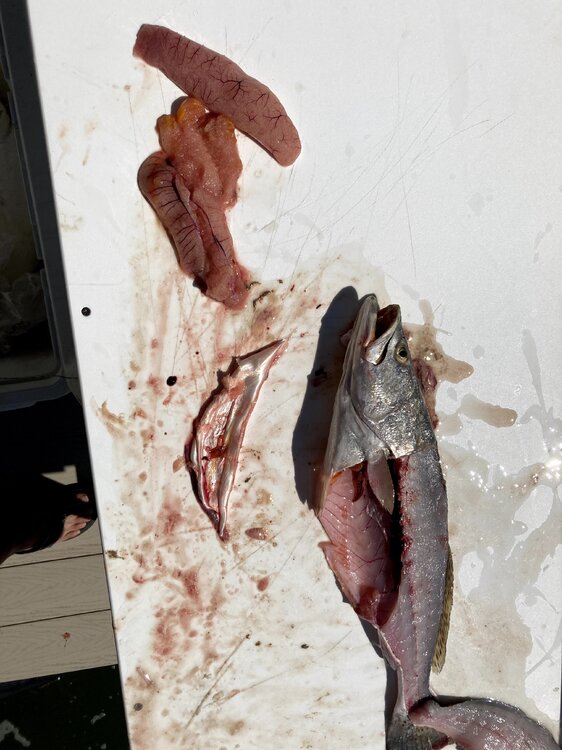
It was eggs. Never seen so many in 40 years of cleaning trout. Don't worry Lower Coast guys, this was Galveston.
-
-
On 6/30/2021 at 9:37 PM, patrickdrinksbeer said:
I found this article to be pretty interesting as a garden oaks resident, former lawyer guy, baseball lover, dad, and local business owner who would benefit from even more population density.
https://www.theleadernews.com/sports/youth-organizations-spar-over-baseball-field/article_227198fa-d9bc-11eb-85d1-13589522bfa4.html?fbclid=IwAR2qTyUgGeDRRilX9p1qpyCfInEWOTDQWnqO7CFUyApkEH27CU_nyjqwdXU
This hits close to home because I played on that field.........in 1978.
-
Looks like those of us in G might catch the very edge of that nasty NE corner.
The 4:00pm report: Doppler velocity data from the Houston WSR-88D radar has shown a large swath of hurricane-force wind speeds in the northeastern quadrant of Nicholas' circulation above 12,000 ft during the past couple of hours, with brief appearances of average velocities of 80-100 kt at high altitudes. Thus, there is an abundance of large-scale cyclonic vorticity available for another burst of intense convection to tap into, which could allow Nicholas to approach hurricane strength by landfall. This would most likely occur tonight during the convective maximum period near landfall where increased frictional convergence along the coast could aid in the development of convection on the west side of the circulation.
On Ventusky right now it shows 80mph in that little section. If it keeps edging East, that might catch the West End. Probably Surfside for sure.
-
Th
Scenario A: Coast hugger
In this case the storm moves close to the Texas coast on Monday, but perhaps doesn’t come fully ashore. It then moves fairly rapidly to the north and then northeast, bringing its center close to the Houston metro area on Tuesday or Wednesday. In this case we would see higher tides—although probably not too great of a storm surge—and wind gusts of tropical storm force in the metro area. However, the heaviest rainfall would likely fall off the Texas coast and potentially in southeastern Louisiana. In this scenario Houston might see 2 to 4 inches of rainfall, with the 20-inch bullseye remaining offshore.
Scenario B: Tour of Texas
In terms of rainfall, this scenario is more ominous. A likely weak tropical storm would move into South Texas on Monday or so, and slow down for a couple of days. The center would remain close enough to the coast that the storm would be able to tap into Gulf of Mexico moisture. In this case, Houston might expect 5 to 15 inches of rain, with a 20-inch bullseye of rainfall coming somewhere in the area from Corpus Christi to Beaumont. But it’s impossible to say where. The potential for heavy rainfall would linger through Wednesday. Winds and seas would be much less of a factor.
Scenario 😄 Riding the Rio
It still is possible that the low moves into northern Mexico and basically tracks along the Rio Grande River, dying out after a few days of being inland. In this case the Texas coast would see some moderate rainfall for a few days, but totals for most areas would probably be 2-4 inches, or even less. This scenario seems a little less likely at this time, but it would certainly have the most benign effects for Houston.
ree scenarios
The map below shows the European model’s ensemble forecast for the evolution of the tropical system, which has been designated Invest 94L. It shows tracks from Friday night through Tuesday evening, and I’ve boxed what I consider three of the most likely possibilities. Let’s discuss each of them.
Three potential scenarios for Invest 94L. (Weathernerds.org/Space City Weather)Scenario A: Coast hugger
In this case the storm moves close to the Texas coast on Monday, but perhaps doesn’t come fully ashore. It then moves fairly rapidly to the north and then northeast, bringing its center close to the Houston metro area on Tuesday or Wednesday. In this case we would see higher tides—although probably not too great of a storm surge—and wind gusts of tropical storm force in the metro area. However, the heaviest rainfall would likely fall off the Texas coast and potentially in southeastern Louisiana. In this scenario Houston might see 2 to 4 inches of rainfall, with the 20-inch bullseye remaining offshore.
Scenario B: Tour of Texas
In terms of rainfall, this scenario is more ominous. A likely weak tropical storm would move into South Texas on Monday or so, and slow down for a couple of days. The center would remain close enough to the coast that the storm would be able to tap into Gulf of Mexico moisture. In this case, Houston might expect 5 to 15 inches of rain, with a 20-inch bullseye of rainfall coming somewhere in the area from Corpus Christi to Beaumont. But it’s impossible to say where. The potential for heavy rainfall would linger through Wednesday. Winds and seas would be much less of a factor.
Scenario 😄 Riding the Rio
It still is possible that the low moves into northern Mexico and basically tracks along the Rio Grande River, dying out after a few days of being inland. In this case the Texas coast would see some moderate rainfall for a few days, but totals for most areas would probably be 2-4 inches, or even less. This scenario seems a little less likely at this time, but it would certainly have the most benign effects for Houston.
This is the latest six-day rainfall forecast from NOAA, but it is only a very rough guide, and localized amounts could be much higher. (Weather Bell)Conclusions
So what actually happens? I wish I could tell you. But we’re talking about a tropical wave that has yet to form a semblance of a circulation, so the forecast models are going to struggle with its track. After that, it’s not entirely clear how much the wind shear currently hampering its organization will weaken over the next couple of days as the system moves northwest or north toward Texas. And these are just the beginning of our questions.
The bottom line is that Saturday should see fine weather in Houston. Sunday should start out sunny as well before rain and thunderstorm chances increase during the afternoon and evening hours. After that heavy rainfall is possible through Wednesday, and we just really can’t say how much. But this is a forecast you should be monitoring closely. We’ll have an update later this afternoon or evening.
-
-
-
We’ve had about 18 hours of high winds and rain but it has finally stopped, wind had calmed down to less than 20 and some sun peeking out. Wasn’t great but not too bad considering. Rest of the week looks fine.
-
-
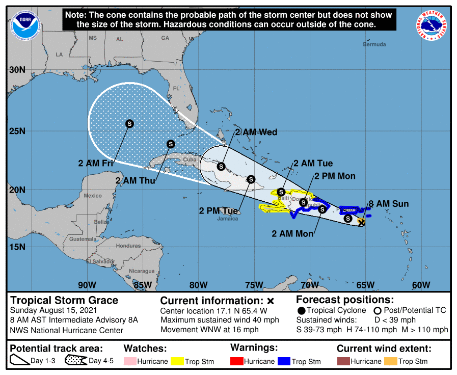
Looks like they missed the Grace forecast pretty bad. She’s coming for us.

-
Pretty big change overnight. Looking like it has slowed down quite a bit and going Westward.

-
-
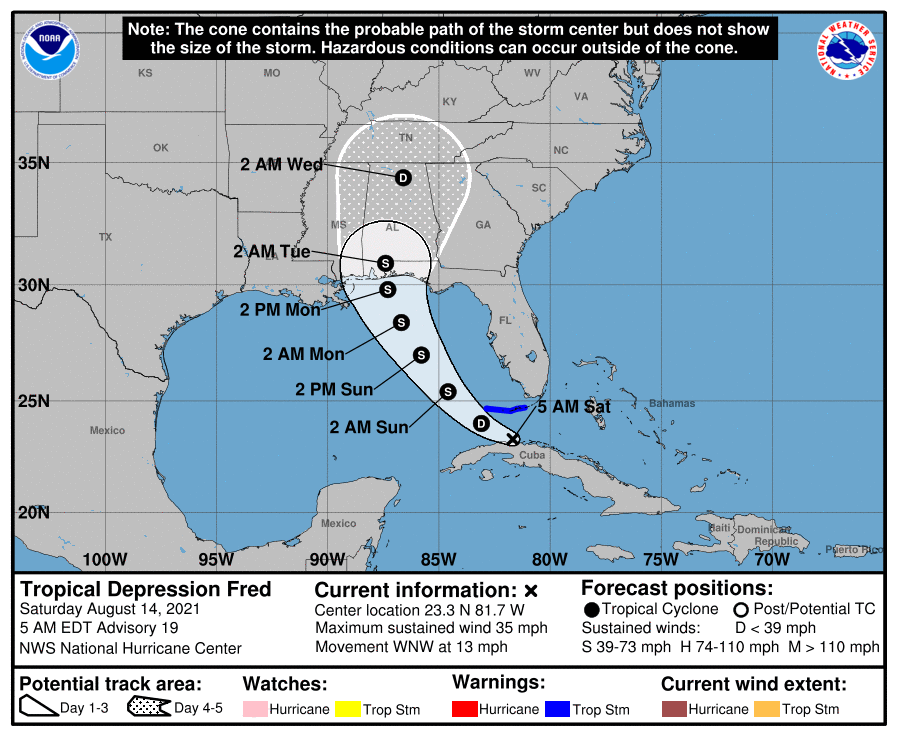
Rented a beach house on St. George Island Florida Sunday through Friday. Hope Fred either picks up his pace and gets on through or hooks East and goes through South Fl. As luck would have it, the projected path right now is a fucking bullseye.
-
 1
1
-
-
On 7/25/2021 at 9:49 AM, Lat22 said:
Did you do any good? I assume you weren't up that early for a boat ride. I was out of town but my bro stayed at my house and fished all weekend. They didn't fare too well in the am but had some decent stringers late afternoon Saturday.
-
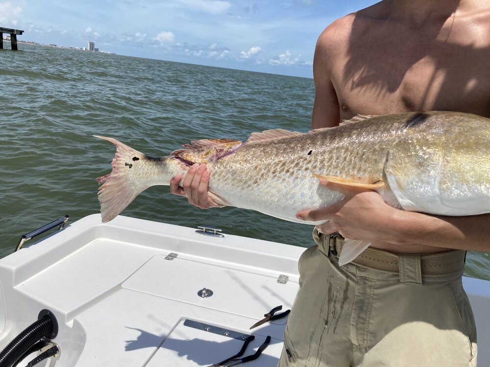
Took the boy out to cruise the beachfront in search of sharks and bulls. Tried right in front of Pleasure Pier first and caught this old warrior. Notice the love bite on the back end.
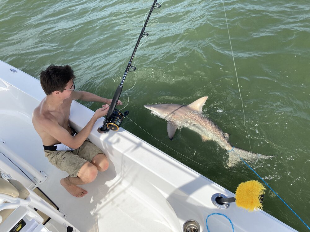
moved on out a little ways to drift behind a shrimp boat and had a double hookup pretty quick. Mine got off but his stayed hooked for a good 30 minute fight.
We kept chasing the shrimper but never got another hookup. Started getting a little bumpy so we headed back in. Good afternoon and the boy got his pb shark so far.
-
 5
5
-
 4
4
-
-
I'm going with a Finetooth. We could tell for sure if we could see the bottom portion of the caudal fin. The finetooth doesn't have a blacktip on that one.
-
-
4 hours ago, GreenspointTexas said:
Real talk: has houston set any type of record over the past 8 weeks?
like most total rainfall over 8 weeks? Or consecutive number of days raining? Or most number of rain days in a month? Or wettest july on record? Or wettest june?
It hasn't been a ton of heavy rain, just a shit load of light rain so I don't think any record inches are being produced.





What the fuck is wrong with you, Houston?
in Cloak Room
Posted
^Very true^
I was just assuming he was asking about actual cell coverage.